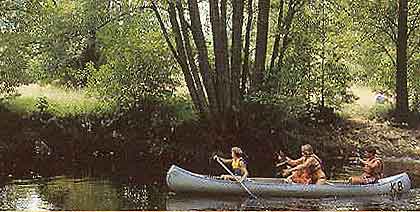
This route is sometimes narrow
and overgrown with trees. It is like paddling in a fantastic green tunnel.
Why not try night paddling?
The canoe route is marked on
the map. It stretches from lake Rottnen in Småland down to Hjorthålan in
Blekinge. It is 50 km long. We recomend you hire a canoe trolly.
Click här
and look for the sign O9.Follow the route on the map and read
the description below.
Description over the
canoe route.
5 km south of Hovmantorp on the east shore of lake
Rottnen there are 2 small bridges. Close to the south bridge over
Ronnebyån you will find a small path 50 meters long leading to a suitable
place for launching your canoe.
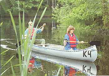
Now your canoeadventure can
begin.
A red sign meens there is a
suitable place for canoe lift, lay-by or campingplace.
One kilometer after Knäsjön
you will find canoe lift stretching app 300 meter..
Now there is a nice paddling
down to Gottamad where you find the next lift app 50 meters. Just before
Gottamad there is a warning for a low line over the stream and after the
lay-by there is a warning for a low bridge. It is forbidden to paddle in
the rapids.
From the dam in Öljeholm there
is a canoe lift of app 500 meters. Choose the right side of the dam.
Follow the embankment to the old powerstation. Here you can camp.
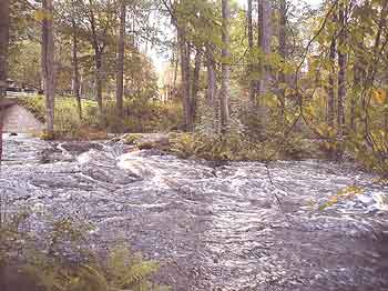
Rapid at Skogskvarn.
At Skogskvarn
we warn for the rapid underneath the bridge and it is also strong current
just before. Lift up the canoe on the left side before the bridge.
The canoelift passing the bridge is ca 100 m. Do not desturb the local
people along the stream. One kilometer further down there is again warning
for a low line.
Lake Viren wideness and on the
east shore there is a nice bathingarea. A couple of hundred meters after
lake Viren you come to Korrö
hantverksby and vandrarhem.
This beautiful place is worth a visit. There is a canoe base, campin
area,, telephone etc. Lift your canoe on the left side of the jetty. walk
up the slope, take left over the parking and then left again. The canoe
lift is app 200 meters. Beware of the you are in Korrö
Naturreservat where regulations are special. After 200 meter is
Svartabäck where there also is a campingarea.
The journey brings you to
Bro
where it is a canoe lift of 100 meters. App 1 km further down is another
camping area.
Soon you see Bastasjön at Flåboda
. Take a look at Flåboda
dommarring. In Vieboda you find campingarea where you can get
water, have a bath etc. A walking tour here gives you a lot to see. for
example jättegravrösen,
tjärdal,
pestkyrkogård,
varggrop, Rössjökanal
etc.
Your trip further on takes you
to Sandsjön and at the south end lies Sjöviksgårdens
vandrarhem in S. Sandsjö. Here you can buy provision, get
fresh water, telephone etc. Outside S.Sandsjö is a small camping area.
You can spend the night in both of this places. Do not stop at the jetty.
Continue 100 m south of the jetty where you can go ashore.
One kilometer after Näset you
will find a canoe lift 100 meters. Do not paddle close to the dam. Follow
markings for canoe lift Take consideration for the local inhabitants.
Next lake is Krokfjorden In the
south east starts a canal going to the power station. In the beginning of
the canal is a low bridge. Please be careful. After powerstation there is
a canoe lift down to the stream . Follow the the marked road. App 200
meters after you have entered the stream again you will find a place for
overnight.
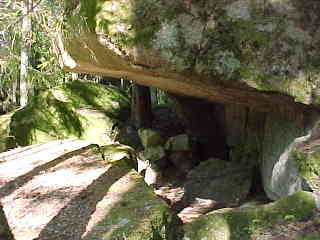
Klostergrottan
If you would like a tour
to Klostergrottan,
3 km away. It is worth seeing.
Paddle past the rapids to the
next powerstation. Lift up your canoe on the west side. Carry the canoe
over to the east side and 700 meters south
The paddling goes on to
Hjorthålan, where you can find over night possibilities , get fresh water
etc. Lift up you canoe at the transformer installation on the left side.
This is the end of this stage
and it will take app. 2-3 days
Have an enjoyable paddle tour.
!!!!!!!
If you would like to continue
further along Ronnebyån you can get descriptions through Korrö
Vandrarhem and Sjöviksgårdens
Vandrarhem. A good route
map you kan get here.